The San Francisco Crosstown Trail, a 17-mile diagonal trek across SF, offers a stunning, hardcore hike and new perspectives on the city I know so well.
The map for the hiking route (the route can also be biked) was released in June of 2019 as a part of the city’s Green Connections Plan — a city initiative to increase access to green spaces within SF.
The trail starts in the southeast corner of the city at Candlestick Point Recreation Area and ends in the northwest corner at Land’s End, though it can be hiked in either direction. According to the trail’s website, hikers spend about 45% of their time on sidewalks, 40% on trails and 15% on paved paths as they wind their way up and down 2600 feet of elevation gain on San Francisco’s notorious hills.
I started my hike, with a friend, at 8 a.m. at Candlestick Point. Local unhoused people commonly use the road surrounding the park as a place to sleep; as the path wound its way directly past the encampment, I felt like an invader as I hiked by peoples’ morning routines. At the time it felt inappropriate that a tourism trail walked right through a place people call home — as if they were on display. Looking back I still don’t totally know what I think but the starting point was an important part of my experience on the trail.
Heading inland, we left the Bayview behind and entered Visitacion Valley, where we trekked uphill through a quiet residential neighborhood and passed through a couple of single lot city parks whose only occupants were practicing Tai Chi — a common early morning activity in SF parks.
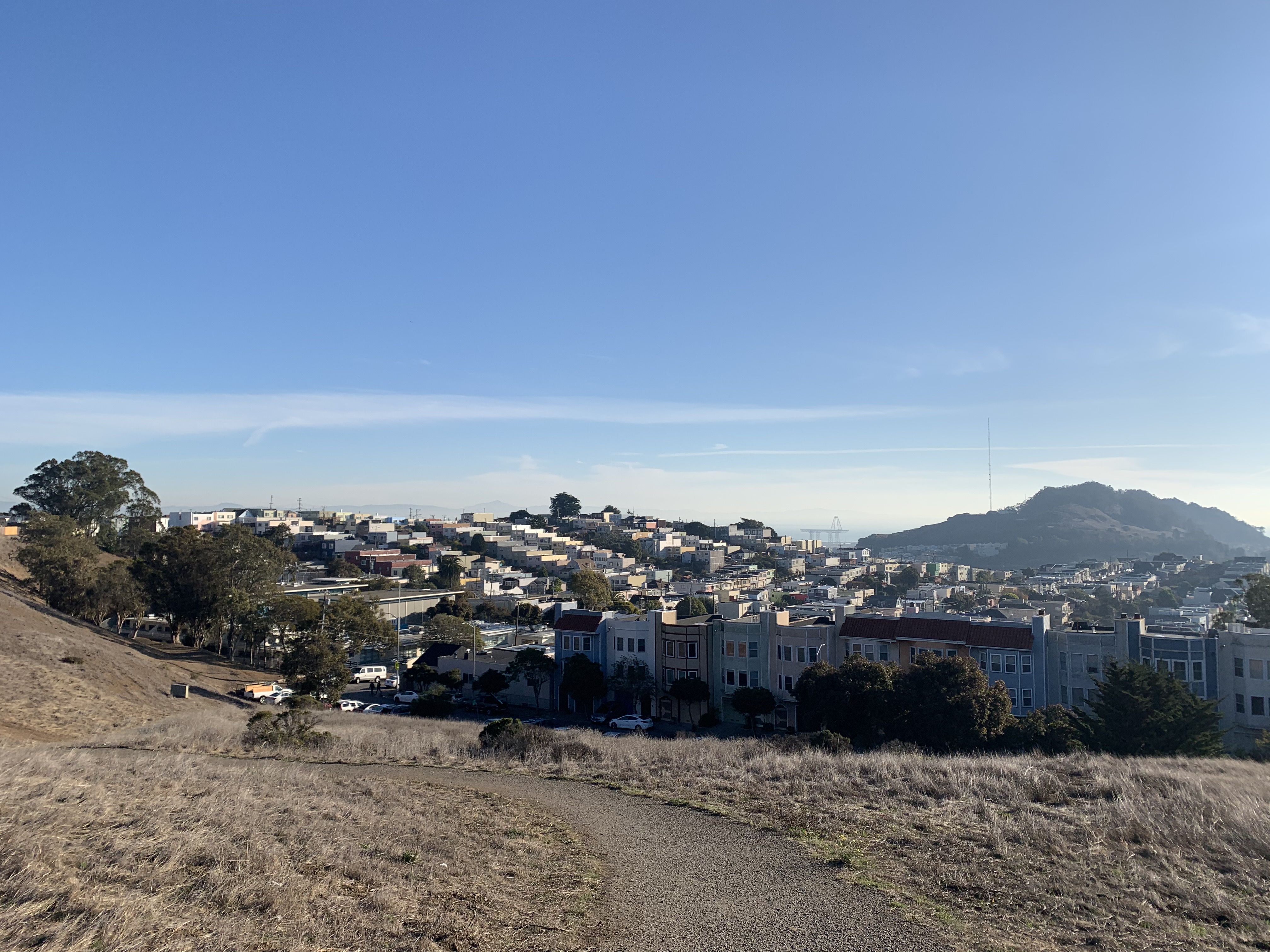
Photo by Caroline Kreutzen
The day before, I had read a couple of articles on the Crosstown Trail from travel and local city blogs. The consensus seemed to be that the first section of the trail, which ends at Glen Park BART, was boring. It was just something that you had to get through to enjoy the rest of the spectacular trail. As we hiked up to the top of McLaren Park I found some fundamental problems with their conclusion. I live in the Inner Richmond and I spend very little time in the southeast of the city; I really enjoyed exploring neighborhoods I had never seen before. Moreover, the view from McLaren park is spectacular. I also think it is shortsighted to dismiss the reality of people’s lives in the most economically disadvantaged part of the city as “boring.” The trail exists to connect people to parts of the city they don’t often visit — not pass judgment on them.
On the other side of McLaren park, which is far larger than I had realized, we walked down to Glen Park BART. From there we were sent immediately up Glen Park Canyon.
After conquering the long, slow uphill through the canyon — which only added to my already mounting leg pain — the trail led us into Midtown Terrace, the neighborhood behind Twin Peaks. There we ran into a very friendly outdoor cat who brushed her white fur everywhere, stalking after us seeking further attention. Considering the scope of the trail and all the sites we saw on the hike it seems silly, but stopping to pet the cat was one of my personal highlights. This random encounter felt like a snapshot of everyday life in Midtown Terrace (I also love cats).
The overhead map of the route does not do justice to the amount of time the trail spends winding through Forest Hill and the Sunset after leaving Midtown Terrace. Be prepared to make seemingly endless circles on twisting roads that stand in contrast to the straight lines and boxes of the rest of the city.
Between the turns, Grandview Park, one of my favorite stops, offers a breathtaking view of the entire north end of the city. From the tiny park set on a hill accessible only by two steep sets of stairs, we could see our final destination: Land’s End. To my tired body, the assurance of a destination in sight was a great distraction from the miles left in between.

Photo by Gabe Castro-Root
Once through the Sunset, we strolled around Stow Lake and into the Rose Garden as the trail ambled through Golden Gate Park. I was newly invigorated by our lunch stop outside in the Inner Sunset and the promise of an end to come.
On the north side of the park, the trail marched us down the tree-filled median between Park Presidio and Funston before meandering down the Lobos Creek Boardwalk in the Presidio.
As we exited Lobos Creek Valley we entered Sea Cliff, walking along the road bordering the cliffs above Baker Beach. However, we could only catch glimpses of the ocean in between the multi-million dollar houses sitting above the beach.
As we walked by each house I couldn’t help but think about where we had started our hike mere hours before. So little time had passed, but the scene in front of us was so starkly different. It reminded me of the vast but often unrecognized inequality that exists within our city.
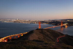
Finally, we reached the Land’s End Trail — the final leg of our hike. As a relatively active person, I was not prepared for how exhausted I was at was this point. Despite the familiar city setting, this is not a hike to be undertaken lightly, a sentiment my friend and I admitted during these last miles. Still enjoying ourselves, we stopped to admire a clear view of the Golden Gate Bridge and twisted around tourists doing the same. This route, which I often run on my own, felt like coming home after the long day of walking. We arrived at Land’s End sore, tired and with about six hours of hiking under our belts.
This is not a hike to be underestimated but it is definitely something every SF local should try. I would not recommend it to the casual tourist who would spend 17 miles looking for a stunning conclusion that simply isn’t there. It is a beautiful, insightful peek into the diversity of people, cityscapes and greenspaces that exist within our city. The trail leaves you with more questions than answers and the distinct feeling that your journey isn’t really over.
