


Photo by Gabe Castro-Root
Mount Tamalpais — referred to by locals as Mount Tam or just Tam — is a staple adventure from my childhood. The mountain, whose name uses the Miwok word for bay or coast mountain, was made a state park in 1963, while Muir Woods, which is surrounded by the park, was made a national monument in 1908. Mount Tam rises 2572 feet above the bay.
Mount Tam offers several hundred miles of trails for hiking, running, biking and even horseback riding. Paired with its five campgrounds and close proximity to San Francisco, Mount Tam is the perfect place for a day or weekend trip to escape the San Francisco fog.
My sister and I became well acquainted with the state park before we could even walk. Later, geared up with toddler hiking backpacks, my parents would spend hours leading us on family hikes that became great excuses to tire out energetic elementary schoolers when we were a little older. As a child, I was fascinated by the winding trails, towering trees and windy vistas of Mount Tam. I have a lot of fond memories associated with the mountain so I was happy to spend my first day of 2021 hiking the 11.5 miles of the Muir Woods to Mount Tam East Peak Loop trail.
Mount Tam has a long history of recreation: trails were built on the mountain as early as 1884. In 1886 a railroad known as the “crookedest railroad in the world” was constructed to meet visitors’ demand. The Civilian Conservation Corps (CCC), a depression-era public works relief program meant to hire the unemployed, is responsible for much of the infrastructure seen on Mount Tam today. They built roads, campsites, trails, visitor centers and amphitheaters, many of which are still in use — with some updates of course! Notably, the CCC constructed the Cushing Memorial Amphitheatre, which hosts events on a regular basis, including the yearly Mountain Play, and is popular with locals. The CCC also built the Gardner Fire Lookout which, located on the East Peak of Mount Tam, was our destination for the day.
The loop begins and ends in Muir Woods National Monument. Every year, 1.2 million people visit the old-growth redwoods protected there. Muir Woods is a quiet place — signs throughout the park ask visitors to keep their volume down. The tall redwoods filter the sunlight, making the main part of the park dimly lit, especially in the morning and afternoon. This atmosphere, along with its well-maintained trails, makes Muir Woods perfect for an early morning hike accompanied by hushed reflections. As a friend and I followed the Canopy Trail upwards out of the canyon bottom, I could tell we were exiting Muir Woods as the redwoods thinned and the sky got brighter.
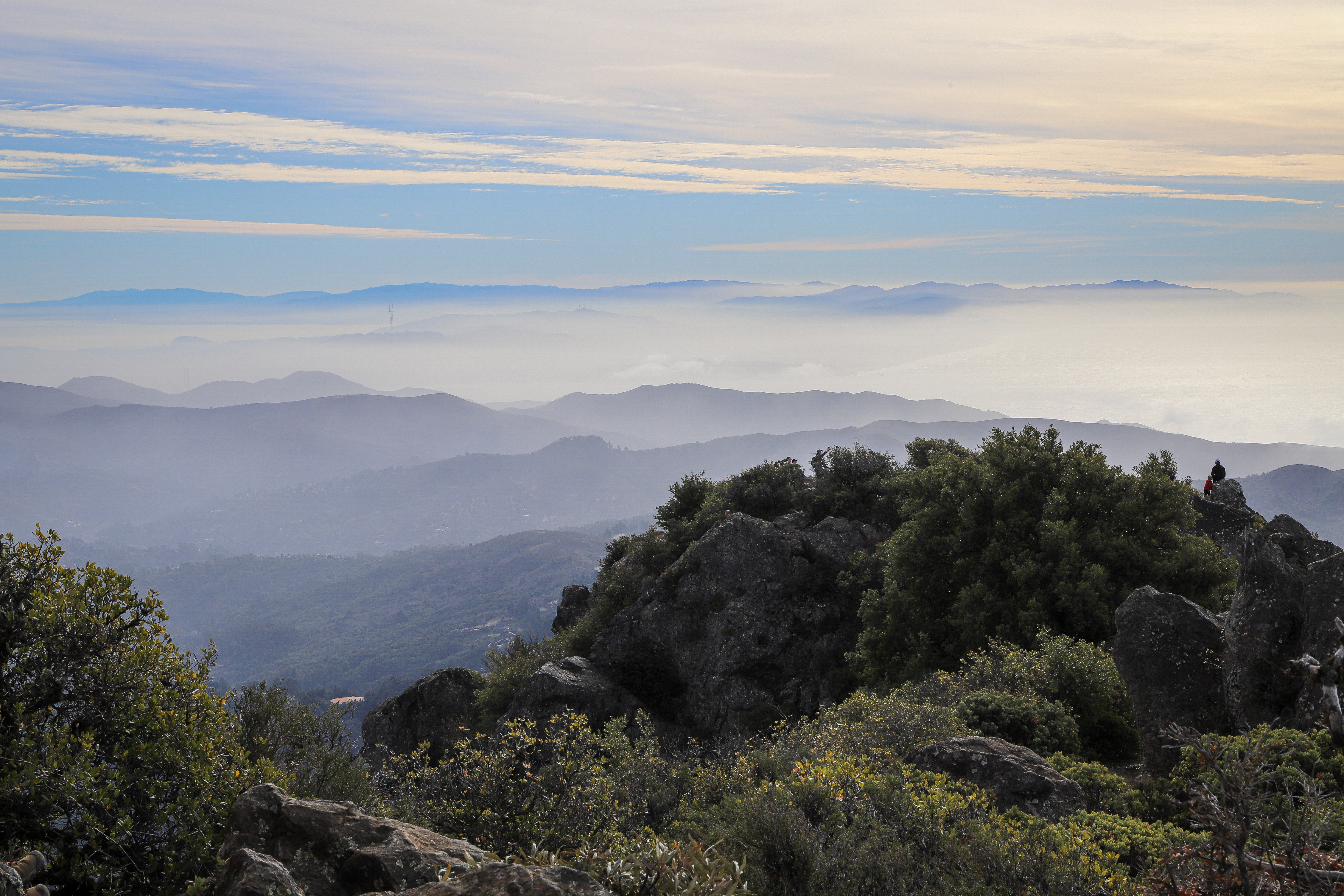
Photo by Gabe Castro-Root
After winding all the way out of Muir Woods, the trail briefly joins with the Panoramic Highway which spans Mount Tam. Along that road sits the Mountain Home Inn, established in 1912 as a stop on the Mount Tam railroad line and one of the oldest restaurants left in Marin County. Though currently closed due to COVID-19, in a normal year, people can dine and sleep at the inn, enjoying the views from its deck perched on the side of Mount Tam.
Once off the highway, we trooped up a series of trails and fire roads climbing slowly higher on the mountain. There is a parking lot on the side of the highway near where we veered onto the next trail. Hiking out and back from there is a good idea for those who want a shorter hike or to avoid the crowds in Muir Woods.
On the way, we passed Sitting Bull Rock, a large rock near the intersection of the Vic Huan and Temelpa Trails. The memorial to the great Lakota leader features a plaque with Sitting Bull’s words, “They claim this mother of ours, the earth, for their own and fence their neighbors away; they deface her with their buildings and their refuse. That nation is like a spring freshet that overruns its banks and destroys all who are in its path. We cannot dwell side by side.”
Sitting Bull’s words encapsulate his condemnation of both the U.S. government’s and European colonization of the globe. Sitting Bull, Tatanka Iyotake, 1831-1890, was Hunkpapa Lakota, an indigenous tribe from what the U.S. calls South Dakota. In the mid to late 1800s, before he was murdered by the army, Sitting Bull led indigenous peoples in resistance to the United States government. In 1876, U.S. General George Custer led the U.S. Seventh Cavalry’s attack on Sitting Bull’s encampment of 8,000 Lakota and Cheyenne along the Little Big Horn. Sitting Bull is immortalized as the architect of the Lakota and Cheyennes’ stunning victory over Custer’s forces at that battle of Little Big Horn.
No one knows who originally placed the plaque on the rock. However, local trail runner Peter Holleran, a resident of San Rafael, admitted to replacing a worn plaque with an exact replica that has now been there for years. The rock is well known by locals and shows up on maps and in guides. It was even granted cultural site status by the state park.
Right before the final ascent of the peak, the path joins with one from the East Peak Parking Lot — so be prepared to deal with larger crowds during your last half mile. This path is a less than a mile loop from the East Peak Parking Lot which takes visitors to the fire lookout and is a great option for those who want to see East Peak and take in the view but are not looking for a hike.
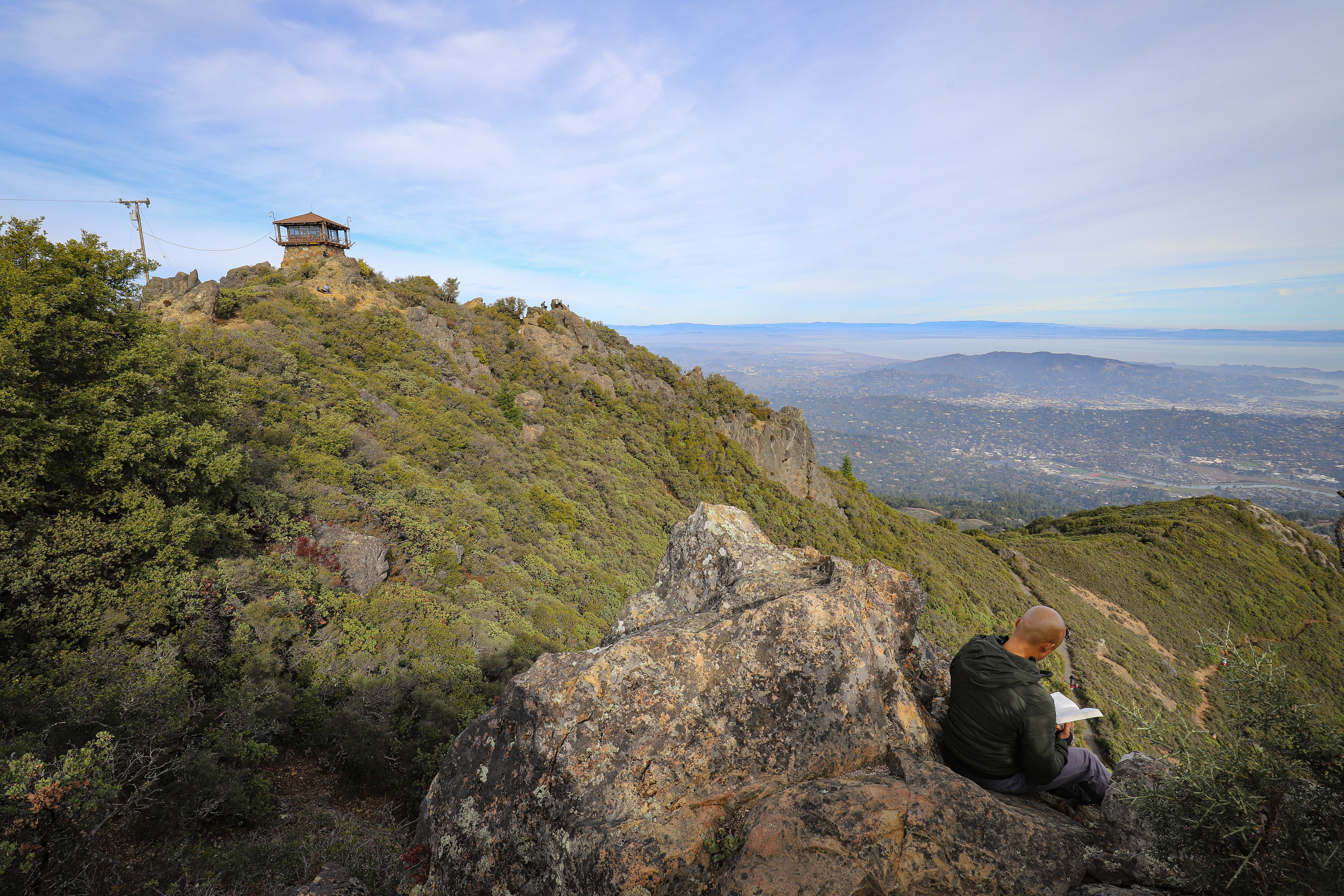
Photo by Gabe Castro-Root
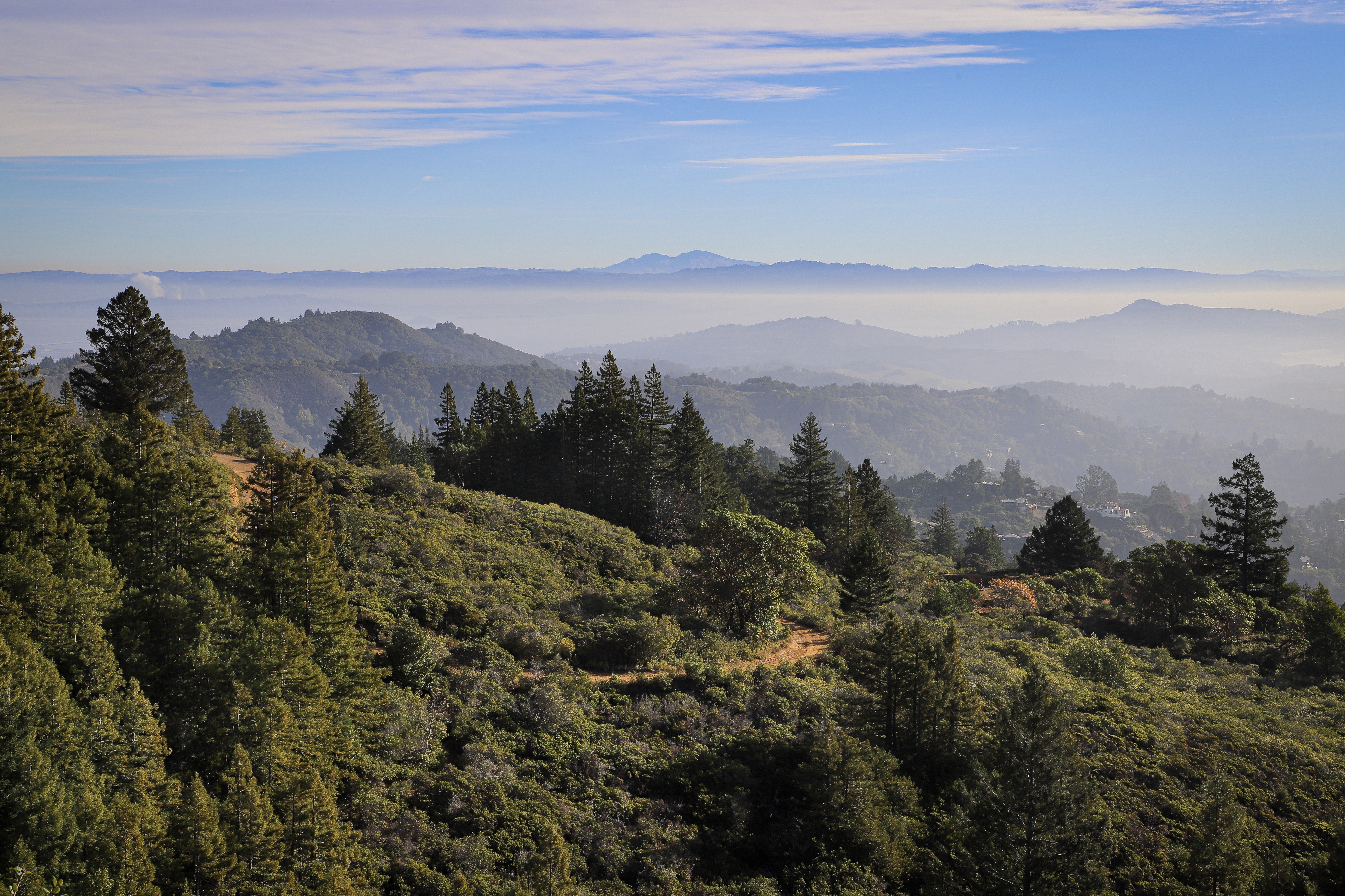
At the top, we were greeted by a fierce wind that had me pulling out the warm and windproof layers I had shed hours ago. The Gardner Fire Lookout, a small building at the summit, is closed to visitors though it is still operational. The Lookout is staffed by Marin County Fire Department volunteers and huddling close to its base does provide some protection from the wind. Despite the weather, the sweeping views were definitely worth the hike. From the top, I could see out over much of Marin to the east and San Francisco to the south. Sutro Tower and the tops of downtown skyscrapers were just poking through the San Francisco fog, but in sunny Marin, I could see clearly out to the Richmond Bridge and beyond it the faint outline of Mount Diablo elevated over the East Bay. The views of the Southeast and East were a beautiful landscape of the mountains and rolling hills that make up the Marin Headlands. We stopped at the top for lunch, sending Happy New Year’s texts to family and climbing around the rocks nearby.
When we were ready, we began to follow a series of fire roads down the mountain. The flat smooth roads, large enough for cars, made for a much easier hike than the small trails we took on the way up. I ambled along enjoying the view.
We stopped for a break at the West Point Inn, joining other hikers and bikers parked on the picnic tables there. The inn was opened in 1904 and, like the Mountain Home Inn, was a stop on the Mount Tam Railroad. It is now maintained by a large network of volunteers that help the inn host events. Members have priority but all are welcome to make a reservation up to 120 days in advance.
The West Point Inn is well known for its pancake breakfasts, which happen on the second Sunday of the month from May to October every year, as well as on Mother’s and Father’s Day. The breakfasts are run entirely by volunteers and, having been to one myself as a child, are an excellent way to spend a Sunday.
After the inn, we wound downwards on Bootjack Trail which took us through both Bootjack campground and Van Wyck’s Meadow, two other spots I remember fondly from my childhood. Following those trails, we were returned to the bottom of Muir Woods. Traffic had picked up considerably. What had been a place of early morning reflection was now a buzzing tourist trail and we were eager to finish our hike to escape the bustle. Luckily, with less than a mile to go, we were out of there in no time and even managed to stop in Mill Valley for a late lunch.
Mount Tam is the perfect place for any adventurous Bay Area locals or tourists to spend a day. Whether you’re replicating our hike or just taking a casual stroll through Muir Woods, Mount Tamalpais has something for everyone to be excited about.